


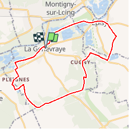
Du canal du Loing aux berges du Lunain

c.chehere
User


5h05
Difficulty : Medium

FREE GPS app for hiking
 SityTrail
IGN / Geographical institutes
SityTrail Plus
The world is yours!
About
Trail Walking of 17.2 km to be discovered at Ile-de-France, Seine-et-Marne, La Genevraye. This trail is proposed by c.chehere.
Description
Se garer à Moncourt Fromenville, sur la droite juste après le pont
Balisé en bleu par CDRP77. Il existe une fiche/topo téléchargeable sur www.randonnée-77.com
En très grande partie le long de cours d'eau.
150 km A/R
Positioning
Comments